All Terrain GPS-free Navigation

Safely complete your flights

GPS-free navigation for low and fast flight, night and day

Small blue arrow

CEP: 10m at speed: 30kn to>0.8 Mach
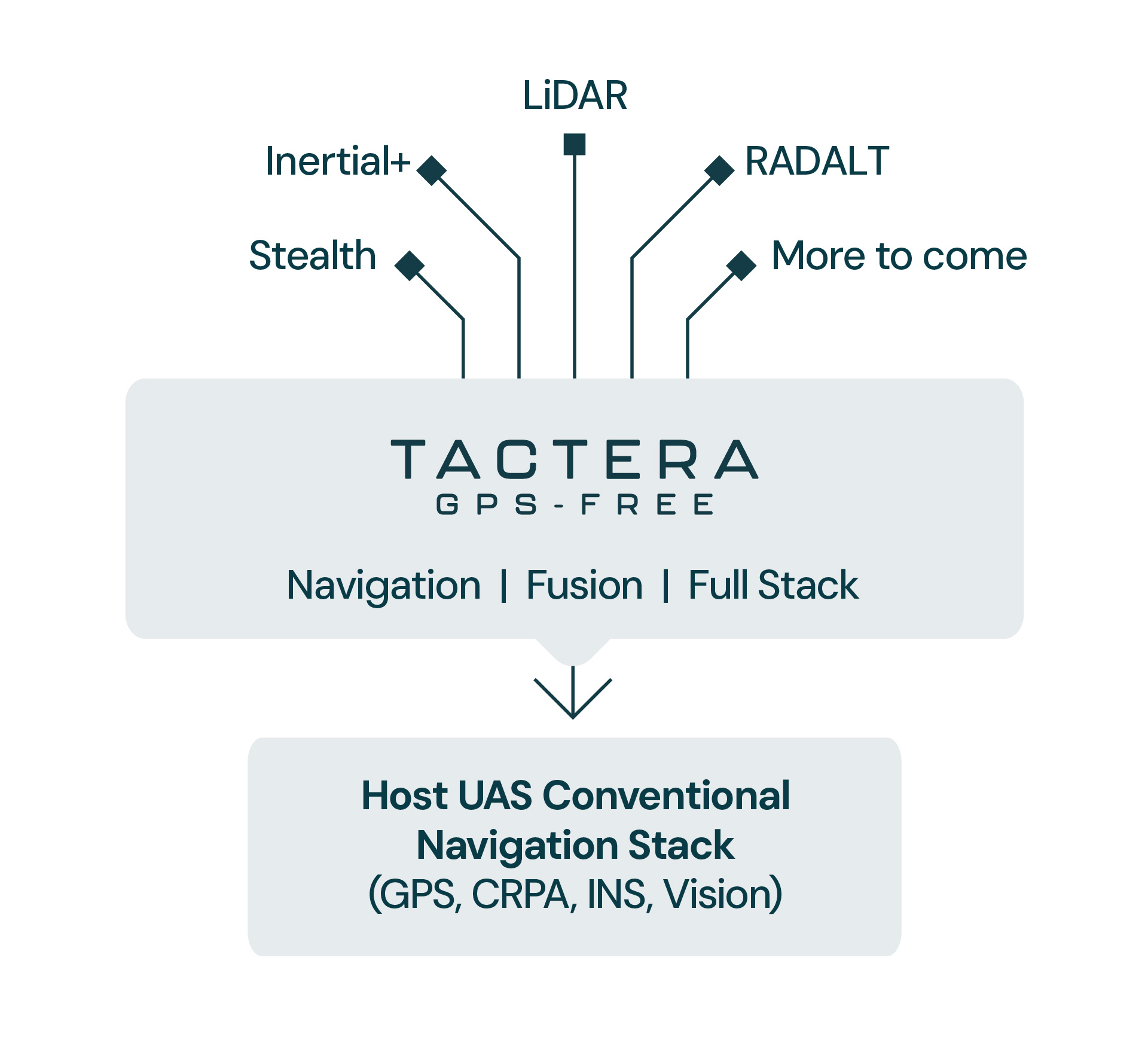
Small blue arrow

No cameras or comms

Small blue arrow

Height: 30ft to 1,000ft

Small blue arrow

Unjammable, unspoofable

Enhance inertial navigation performance with software

Small blue arrow

Typically only 5km drift over the first hour

Small blue arrow

No cameras or comms

Small blue arrow

Approaching Navigation grade performance

Small blue arrow

Uses your existing hardware, signals and data plus our software

Divider-v2

Fly through GPS jamming & spoofing

Scenario: Industrial inspection multirotor

With Tactera and Intera from Flare Bright, you can intelligently detect GPS signal failures and seamlessly navigate without GPS. Complete flight avoiding interruption or delays, and safely return home. Experience robust protection against GPS interference and outages.

Benefits

Small blue arrow

Lower insurance costs due to safer operations.

Small blue arrow

Easier permissions to fly in urban areas.

Small blue arrow

Fewer crashes means reduction in delivery delays.

Small blue arrow

A quick calibration flight and you are ready to go.

Tactera Evaluation System

Arrow blue left

Tactera suceeds where others struggle

Low (10-100m) and Fast (400-500kn)
Night and/or bad weather
Rugged terrain
Flat terrain
Open ocean
Low to no EM emissions
Land Strike Accuracy (<10m CEP)
Struggles
Struggles
Struggles
Radar Terrain Navigation
Struggles
Tactera (LiDAR 

Terrain Navigation)
Struggles
Tactera Marine
Tactera Swarm

All using Flare Bright software-enhanced automotive and cellphone hardware. UK Sovereign Capability, ITAR-free.

Arrow v2

Contact us for a quote

Please let us know how many units you require and your lead time for delivery.